Thursday 27 October
Cooktown
Following a laundry session I walked to the Botanical Gardens. Most reasonably sized towns in Australia have very well presented botanical gardens. The one in Wagga, for example, also has a little zoo containing a selection of indigenous animals and birds, two large children’s playgrounds and a cafe. This one in Cooktown had been refurbished over recent years and was pristine. I visited the Cooktown Museum, formerly called the Captain Cook Museum, which is housed in a stunning 19th Century convent building. It showcases the fascinating history of this remarkable town. The museum follows the story of Captain James Cook’s enforced seven week stay at the Endeavour River, during which the first meaningful contact between Europeans and Indigenous Australians took place, to the days of the Palmer River gold rush, as well as personal stories and items from Cooktown’s early residents. The Endeavour Gallery gives a fascinating insight into the seven weeks Cook and his crew spent at the site of modern Cooktown repairing their ship after their catastrophic grounding on nearby Endeavour Reef. The highlight of the gallery is the original anchor and cannon from the Endeavour, jettisoned from the ship in 1770 and only retrieved from the reef in the early 1970s. The Endeavour Gallery not only explores the fight for survival Cook and his men faced on the reef, but also documents the many discoveries made by the scientific team during their stay at the Endeavour River. Integral to Australian history and identity is the interaction between Cook and the local Guugu Yimithiir people Although described as one of Queensland’s best museums I felt it was pretty old fashioned and in need of updating. I wandered around town looking at sites of interest, all revolving around Cook’s fairly brief sojourn in 1770. I had a good salad lunch in the Sovereign Hotel where the barman came from a place very close to Sligo, and then rushed back to retrieve my washing from the line as I had been told that rain was imminent. I dined in my cabin on fresh fruit.


Friday 28 October
Cooktown - Mount Garnet
I departed Cooktown at 0815 in sunshine and a temperature of 32℃. I reversed much of Tuesday’s route until the turnoff at Mossman where I continued south until Atherton where I began to head west on the Kennedy Highway. I was reminded of the car wrecks I had seen on the way up - there were five very recent ones and the thing that always strikes me, because of the many flower bedecked shrines, how many are on straight stretches of road, rather than on bends which would be the case at home. I can only surmise that they are caused by people falling asleep at the wheel, particularly considering the long distances travelled here and the often long straight roads. Indeed, there are regular signs along the highway encouraging drivers to take a break and refresh.


The road was very interesting at this point crossing the Barrons Range, The Sussex Range, The Hann Tableland and the Atherton Tableland. My objective was Mount Garnet where I planned to camp. I have an app, WikiCamps Australia, which provides a comprehensive list of campsites of all types in the country. As I left Atherton at about 1400 I noticed very dark clouds in the distance. It began to rain so I stopped and donned my waterproof jacket; I decided not to bother with the trousers as I thought that wet jeans would help to keep me cool - it was 36℃ at the time. The road started climbing and suddenly the heavens opened accompanied by gale force winds. Visibility was reduced to less than 10 metres and I was forced to reduce speed dramatically. There was tremendous thunder and lightning and then it began to hail. I pulled in behind a ute which had stopped at the roadside, as had all other traffic, partially sheltered by a high bank. I hunkered down on the bike with the engine running being battered by large hailstones. After about 5 minutes the wind shifted through 90 degrees and was directly behind me. The ute moved off and I followed for a while but visibility remained poor and I fell behind. Then, almost as suddenly as it had begun, it stopped, the clouds cleared and the sun reappeared. I stopped to remove my jacket as the temperature, which had dropped to 22℃ during the squall, had climbed back to 35℃. My jeans were saturated and my boots sodden and awash, but I was warmed by the warm air. I decided to check into the small motel by the petrol station in Mount Garnet to dry out. A little later there was a torrential downpour accompanied by strong winds. I was glad I wasn’t in the tent! I walked along to the only pub which had no draught beer and only a few bottles and cans in the fridge. My stay was short and I ate in the cafe attached to the service station.
394 kms travelled.
Mount Garnet - Croydon
Leisurely start leaving at 0930 after chatting to three elderly indigenous ladies. By and large the road was undulating with gentle curves, initially along the Kennedy Highway and then the Gulf Development Road, the Savannah Way. (Developmental roads were originally built to facilitate the transport of stock in the far reaches of Queensland. They retain the name because they are under constant repair and development.) There was mostly scrub and small trees, especially after leaving the influence of the Great Dividing Range. I rode through Undara Volcanic National Park where, as the name suggests, there is much evidence of historical volcanic activity. I stopped at the Mount Surprise Roadhouse where I had an interesting conversation with the women running it. It transpired she is a singer and of aboriginal descent. I mentioned that there had been an article on that morning’s television news about an autobiography written by Vicki Bull and her sister, both well known singers of aboriginal descent, and that my late wife and I had been to a concert in Portsmouth several years before where Vicki Bull performed in a show covering the life and songs of Etta James.


367 kms travelled.
Sunday 30 October
Croydon - Burke and Wills Roadhouse, Four Ways
Terrible night’s sleep - it remained so hot that I was bathed in sweat all night long although I had
the tent flysheet open front and back, all accompanied by throbbing music until 0330. The site
was in the middle of the small town and there must have been some party going on judging by the
sounds of revelry accompanying the music. The ride to Four Ways via Normanton was pretty
uninspiring, flat with largely scrub and large tracts of floodplain.

Some of the road was, again, single track with a wide gravel verge, confirming its status as a
development road.
 2
2


The temperature during the day rose from 34℃ to 44℃. I had planned to camp for the night at
the Burke and Wills Roadhouse campground but in view of the previous night’s experience in the
heat I paid for a basic cabin with air conditioning. Jun, my Japanese companion, had planned to
ride on to Cloncurry but changed his mind and booked a cabin as well. He said that as his English
is not very fluent he feels reassured having me to help him. Normally, when it is hot I ride with my
visor open to help cool my face. In this heat my visor stays firmly closed - the air is so hot it is like
being blasted with a hair dryer on the highest heat setting. Did some laundry and showered (the
water coming from the cold tap was so warm there was no need to touch the hot tap!). My washing
was dry in less than an hour on the line.

351 kms travelled.
Monday 31 October
Four Ways - Camooweal
Left at 0845 at 34℃ following a good night’s sleep. The first 30 kms was pretty dull with flat
landscape and brush. Then things improved with a more interesting road with views for the next
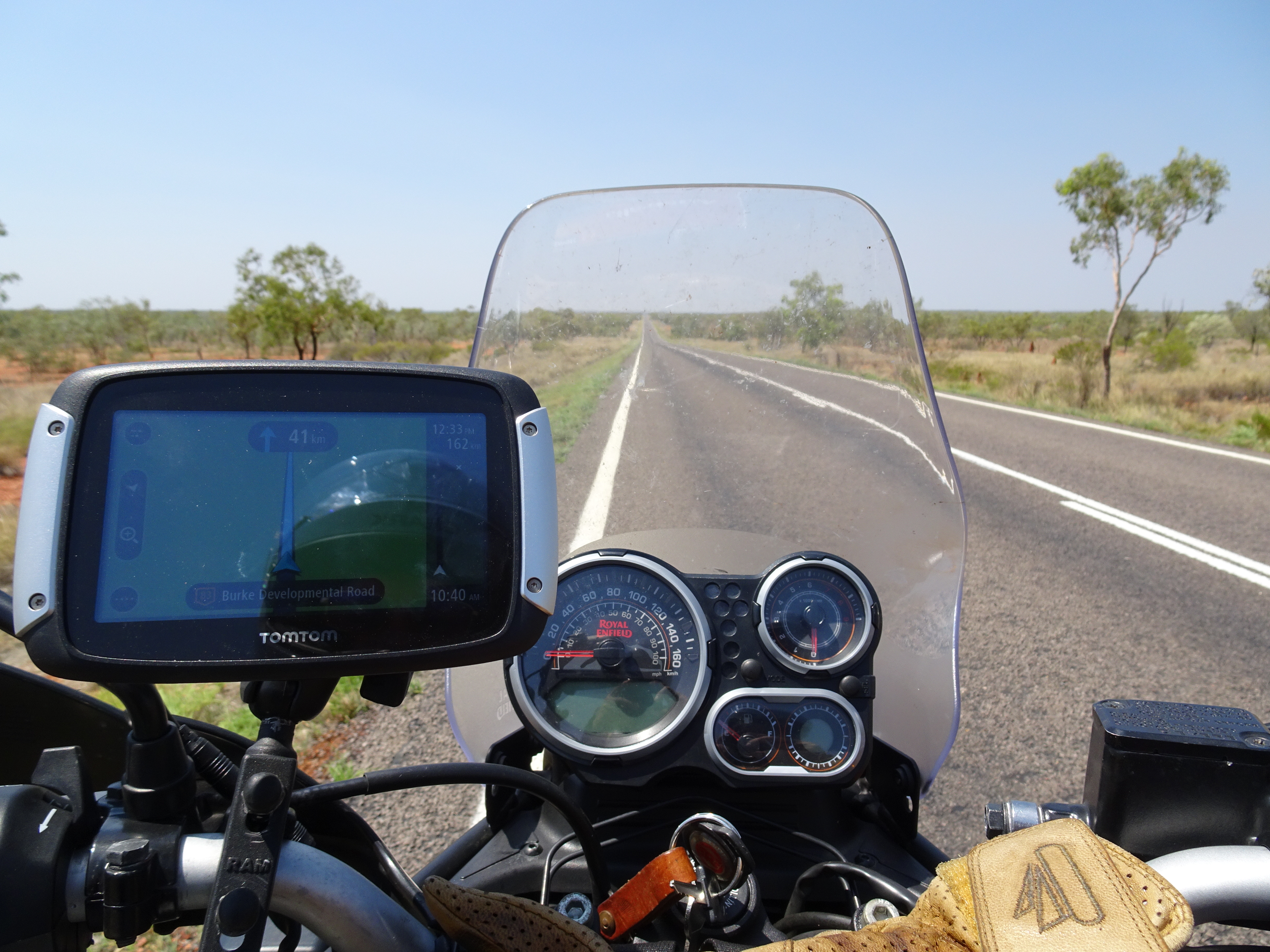
stretch to Cloncurry following the Burke Development Road skirting the Waggabonyan Range
and heading due south. My route turned west at Cloncurry to follow the Flinders Highway until
the large mining town of Mount Isa where I joined the Barkly Highway towards Camooweal.
The road now crossed the Waggabonyan Range with spectacular rocky outcrops, cliffs and hills.
The road traversed numerous hills, skirting rather than climbing the largest ones. We had
enjoyed a following north easterly wind to Cloncurry but it then shifted to the north west and it
became quite strong making for difficult riding and increasing fuel consumption. The final 60
odd kilometres to Camooweal was flat and bordered by low scrub. The temperature had risen to
42℃ in the late afternoon so an air conditioned cabin was taken again. It was quite a long day
but the border to the Northern Territory is close.
488 kms travelled.
Tuesday 1 November
Camooweal - Tennant Creek
Not a good night’s sleep, despite the long previous day. Although I was up at 0600 I fiff faffed
around and didn’t leave until 0815 at a comfortable 27℃. This temperature obtained for several
hours and peaked at 34℃, very pleasant after the last few days of 44℃. We reached the
Northern Territory border after about 20 kms.


The terrain was quite dull, flat grassland and scrub and with evidence of large herds of cattle.


The evening temperature was perfect.
465 kms travelled.
Wednesday 2 November
Tennant Creek - Daly Waters
A good night’s sleep. The temperature fell during the night and I opened the sleeping bag to use
as a covering. The wind came up which made breaking camp difficult. Left at 0845 at 25℃.
The road is now the Stuart Highway which runs all the way up to the centre of Darwin and which
crossed a number of small ranges of hills.


Stopped a couple of times to refuel including in a place called Elliot. Later I was speaking to a
guy who was driving from Victoria to Darwin and who had decided not to stop in Elliot because
all the properties were enclosed by high fencing and the servo was fitted with bars and heavy
grills over the windows and doors. Again, communities with large indigenous communities
appear to be unsafe. There is certainly a different atmosphere in the Northern Territory. The
temperature slowly rose as the day progressed and it had reached 40℃ by the time we reached
Daly Waters. Although the humidity didn’t appear too bad it was stifling and I opted not to camp.
I realised that apart from two emus the previous Sunday, some mules on Monday and kangaroos
and wild pigs in campsites, I had seen no animals on the ground, I assume season related,
particularly the heat. Daly Waters contains one of the most famous outback pubs and has a
reputation for riotous evenings. Although I took advantage of happy hour, there was no partying
and I retired early.


400 kms travelled.
No comments:
Post a Comment