Wednesday 24 June
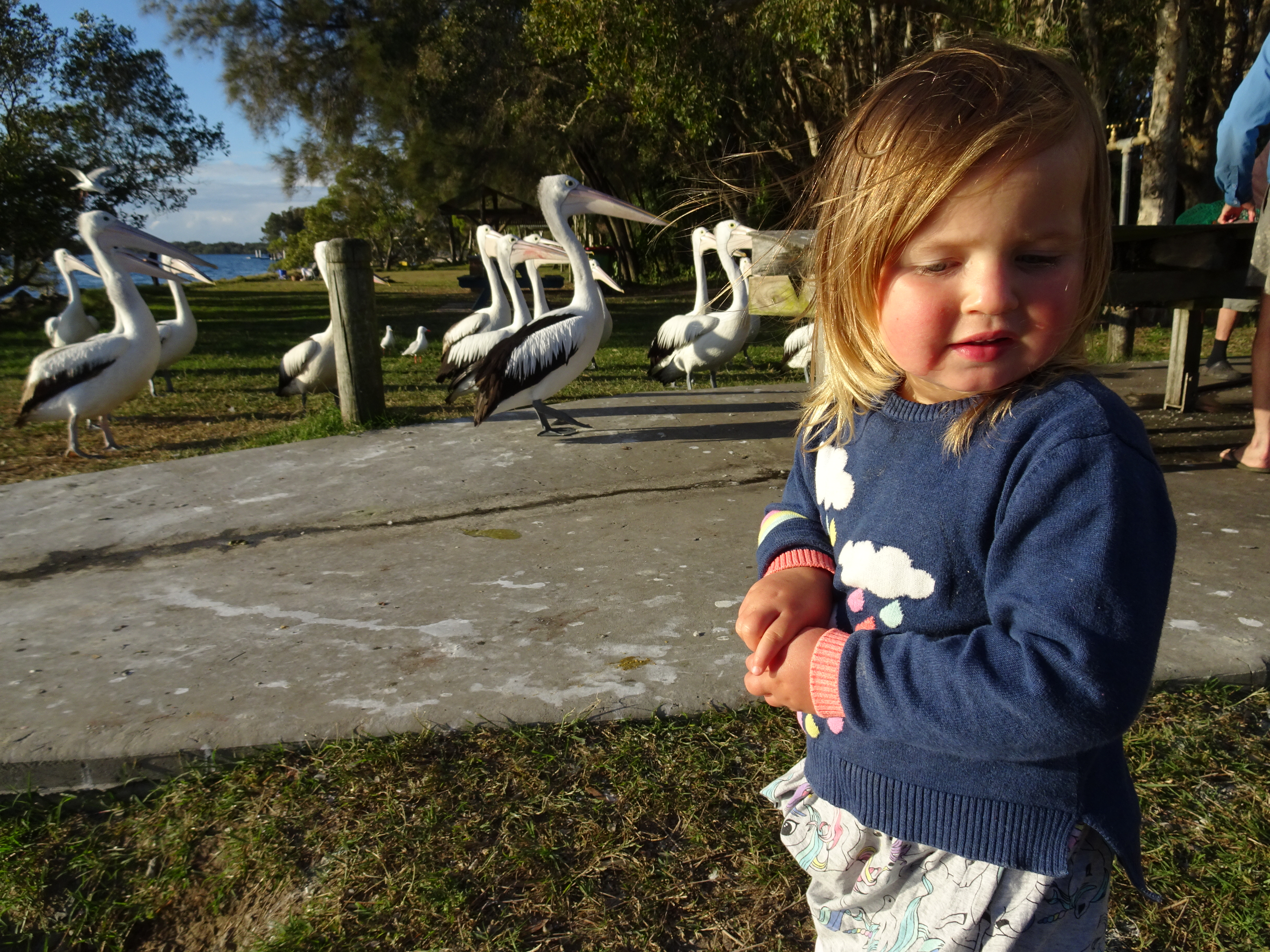
The chief purpose of this trip was to visit Amy, the daughter of good friends in Emsworth, her husband Rob and young daughters Letty and Penny who live in Yamba, a town on the north east coast of New South Wales.
I left Wagga in bright but chilly weather. The intention was to get to Yamba by Friday afternoon, i.e. 1100 kilometres in 3 days. This meant a relaxed ride but with little time for deviation and sightseeing. I had travelled part of the early section of the route before but in the opposite direction when scenery often looks very different. I was wearing new gloves having returned a pair bought several weeks earlier because the stitching on both gloves was beginning to fail. The replacements, again the same Australian brand, were advertised as winter gloves but I was struggling with very cold fingers on the ride. I stopped to refuel at West Wyalong and warmed up inside the service station with a pie and coffee. I continued to Dubbo on the Newell Highway passing the Parkes Observatory which I would like to visit some other time. I reached Dubbo just after 4 and checked into the Atlas Motel. I warmed up and later walked the short distance towards the centre of town and enjoyed a tasty curry in the Royal India Restobar.
Distance: 402kms.
Thursday 25 June
I took the Golden Highway from Dubbo and after Coolah I joined The Black Stump Highway passing through the Coolah Tops National Park. I was heading north east and was disappointed that the temperature was not rising as I had expected. My destination was Tamworth, altered from Armidale which was forecast to be colder, and as I reached the outskirts I spotted a large motorcycle dealership. By this stage I was directing verbal abuse at my gloves because my hands were so cold. I entered the dealership and asked for the warmest gloves they had. I was tempted to buy some heated gloves which were powered by built in rechargeable batteries but instead selected a pair of French made Goretex gloves - what a difference! Well worth the expense. I booked into the quirkily named Abraham Lincoln Motel which is run by an Indian family. I ‘dined’ that night in an Italian restaurant linked to a Best Western motel down the road where I had a delicious calzone, probably the largest I have ever eaten.
Distance: 324 kilometres.
Friday 26 June
The motel price included a continental breakfast which was delivered to the room. After a leisurely start to the day I set off towards Armidale on the New England Highway. I turned off onto the Waterfall Way, a glorious, twisty, scenic route crossing the Great Dividing Range towards Grafton. The weather was sunny and the temperature mild and the riding was superb

. I stopped at Guy Fawkes River National Park to see the Ebor Falls.


A little further on I left the Waterfall Way to join Armidale Road into Grafton, the best piece of biking road. From Grafton it was a short stretch to Yamba, although I and my GPS were confused by a newly opened stretch of motorway. I rode through large swathes of sugar cane reminding me that the climate on this side of the Great Dividing Range is a lot warmer. As I pulled up outside their house Amy, Rob and the girls emerged from the garage to offer a very warm welcome.
Distance: 374 kilometres.
Saturday 27 and Sunday 28 June
I enjoyed a delightful weekend which included a visit to Maclean, a very Scottish town with lampposts and telegraph poles encased in tartans, a look around Yamba, and a trip around the estuary in Rob’s boat where I saw 4 sea eagles at very close quarters. I was treated to good food all washed down with cold beer, and had fun playing games with Letty and Penny.


Monday 29 June
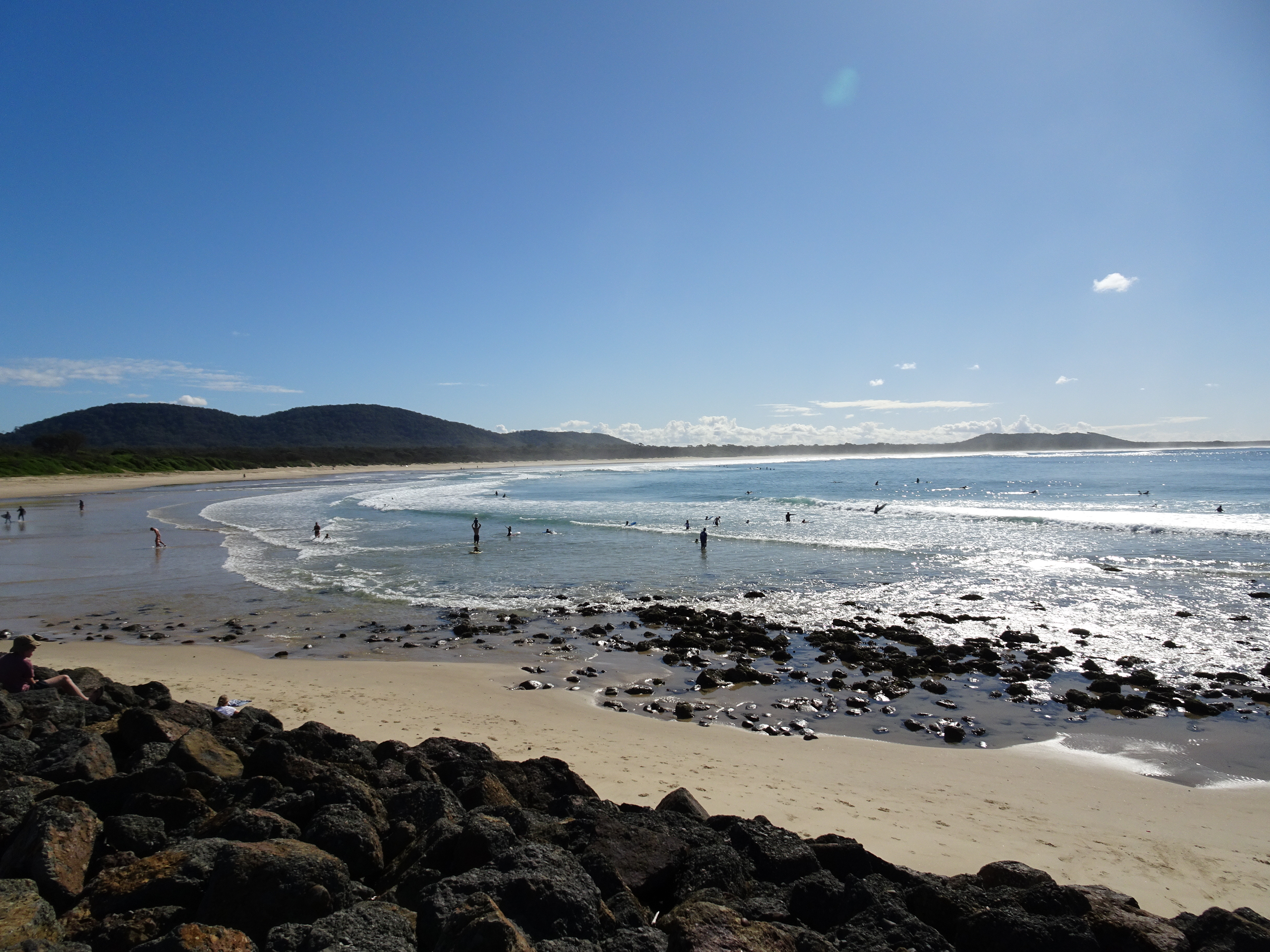
I left Yamba to meander down the coast for several days before making my way back to Wagga. I diverted to the coastal town of Woolgoolga for coffee and the customary egg and bacon roll where the waitress recommended several must see places on my route south. I followed the Pacific Highway chiefly as there is no road that hugs the coast. I turned off to visit Sawtell, one of the places particularly recommended earlier. Its main street has large trees growing down the centre providing welcome shade and areas where people could sit and enjoy coffee etc.

The beach area was also spectacular and it is easy to appreciate why it is such a popular holiday destination.


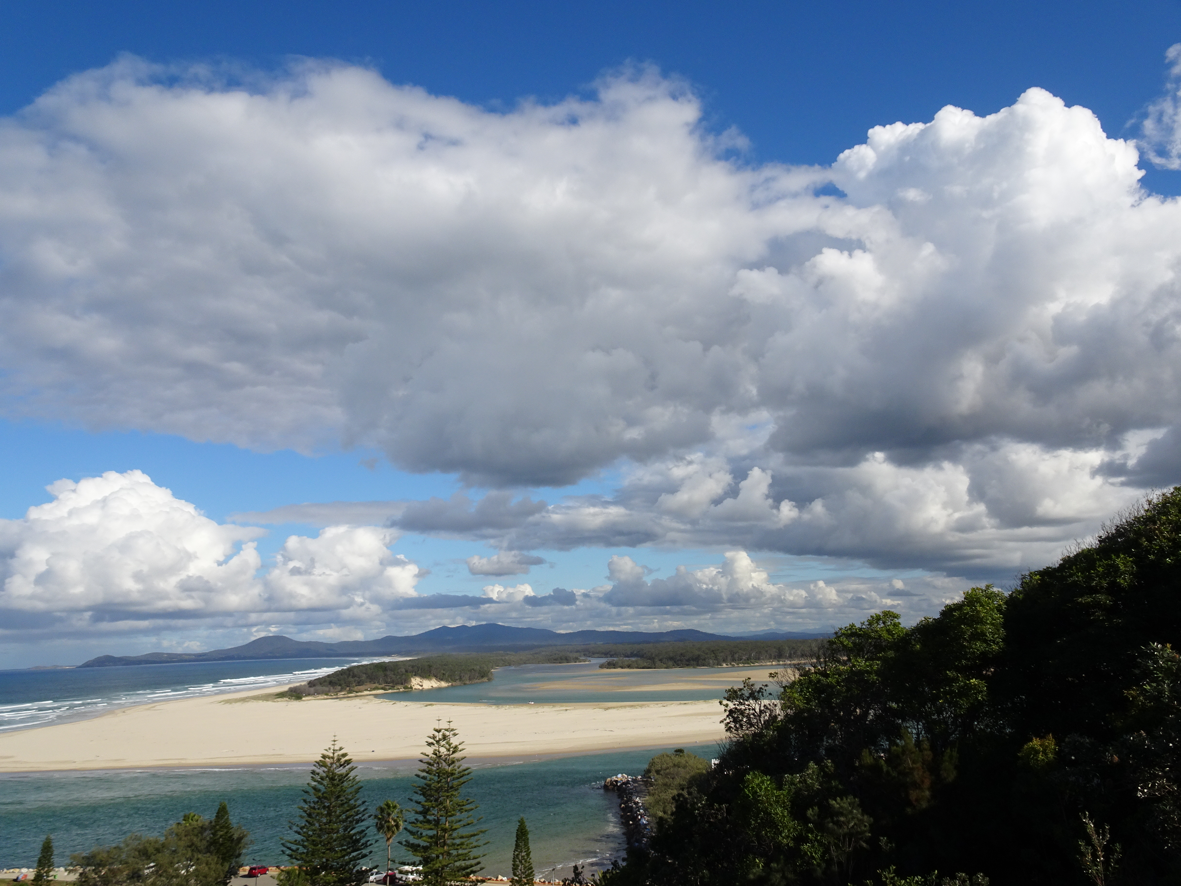
My next diversion was to Nambucca Heads where from Wellington Rocks I had a splendid view southwards of a beautiful beach and estuary.
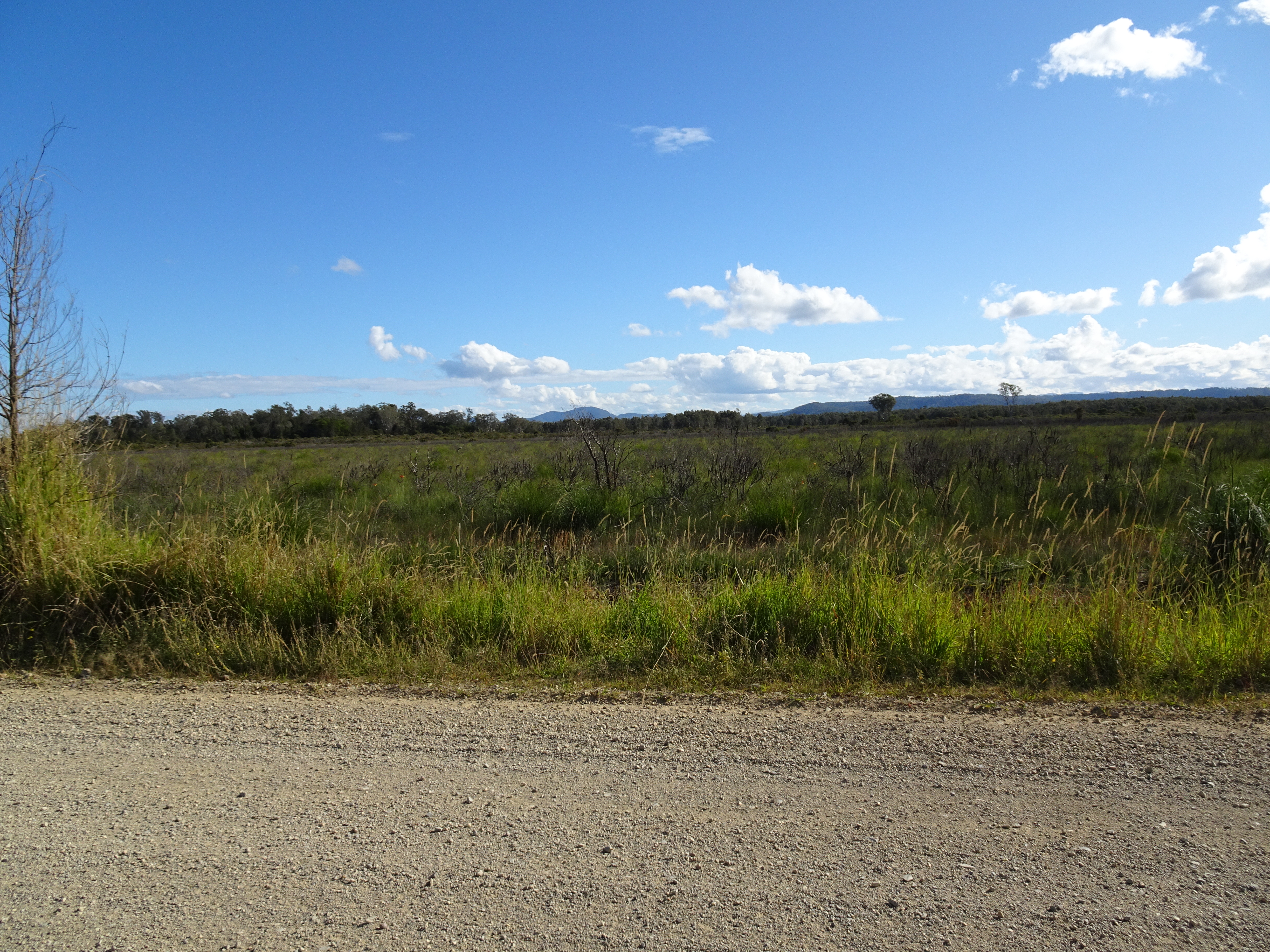
Having seen something of the coast I decided to head inland for a while and from Macksville I took Taylor’s Arm Road which soon became unsealed and which took me through undulating farmland. The surface was not well graded and I spent several hours negotiating some interesting surfaces.


At one stage, although my GPS mapped a through road, there was a locked gate barring progress so I turned around and found another route. I have discovered subsequently that it is not uncommon for farmers to block little used roads to protect their free roaming livestock from traffic. One bloke I spoke to often carries bolt croppers to open such gates. I had selected a motel on the outskirts of Kempsey for my overnight stay and I pulled over and booked a room online. The reason for my selection was that a highly rated Indian restaurant was integral to the motel and I fancied a good curry (as is my wont). On arrival I discovered that the restaurant was closed because of Covid. When I expressed my disappointment to the receptionist, a Thai, he offered me the use of his car to drive into town to find a restaurant. I declined the offer and instead rode to a supermarket where I bought a microwave meal and then to a bottle shop to buy some beer, all consumed back in my motel room.
Distance: 312 kilometres.
Tuesday 30 June
I rode from Kempsey to Crescent Head, another of the recommendations, a distance of 20 kilometres. I parked by the beach, bought a coffee and a pie, and sat at a picnic table opposite an elderly couple. The tide was quite high and there was a large number of people surfing. I was sitting with my back to the sea with the intention of turning to face the beach once I had finished eating the pie. I got into conversation with the couple and by the time I managed to turn as planned the tide had receded somewhat, as had the waves, and as had the surfers therefore!


Nonetheless, the conversation was good and wide ranging. Included was the topic of a very well known and popular brand of cheese in Australia, namely ‘Coon’ which was named after its American founder, Edward William Coon. The company had been under some pressure because of the racial connotations of the name, particularly in the recent Black Lives Matters campaign. After 85 years the name is to be changed. The couple said that they had spent a number of years living in Coonabarabran and wondered if the first part of the name would be changed! Incidentally, it’s of Aboriginal origin.
I rode a dirt road from Crescent Head following the coast to Point Plomer in Limeburners Creek National Park passing several attractive beaches along the 20kms travelled.


I made my way to Port Macquarie where I was to spend the night and where I enjoyed another good curry dinner. Only 99 kilometres ridden today, but frequent stops to admire the views and at a very relaxed pace.
Wednesday 1 July
As I left Port Macquarie on the coast road just after 9am I passed a heavily manned police checkpoint on the other side of the road stopping cars travelling into town for the drivers to be breathalysed, a reminder of how seriously Australian authorities regard drink driving.
After 30 kilometres or so riding along the delightful coast road I rejoined the Pacific Highway having skirted the southern shores of Queens Lake at Laurieton. Around 70 kilometres later I left the Highway to investigate Seal Rocks, but saw no seals! Next diversion was to Nelson Bay (had to be done in view of my background). I enjoyed a coffee and a barramundi filled roll whilst overlooking the sound.


Bypassing Newcastle I was looking forward to riding the narrow piece of water flanked land 40 kilometres southwards towards The Entrance but was disappointed as the road was lined by tall bushes which blocked most of the views. I spent the night in a motel in Toukley.
Distance: 409 kilometres.
Thursday 2 July
Today I had to start making my way back towards Wagga which meant leaving the coast and heading west via the Blue Mountains. Eschewing the Highway I found Dog Trap Road (what a great name) north of Gosford which took me towards Mount McPherson and Wisemans Ferry Road following the Hawkesbury River for a considerable way. This was a good morning’s ride with both roads offering multiple bends, great views and the former, hilly terrain. I stopped at Spencer for an early lunch. The owner of the store/cafe had only just put pies in the heater and recommended a bacon and egg roll. Spot on, the best I have had in Australia.


The ride along the river was sublime, good surface, blue sky, sunshine and sweeping bends.


I crossed the river on Wisemans Ferry and climbed to the Blue Mountains to the north of Sydney.


A feature of riding some of the minor roads in this area is the number of ferries rather than bridges at rivers. I guess it is more economical to operate free ferries than to build and maintain bridges.


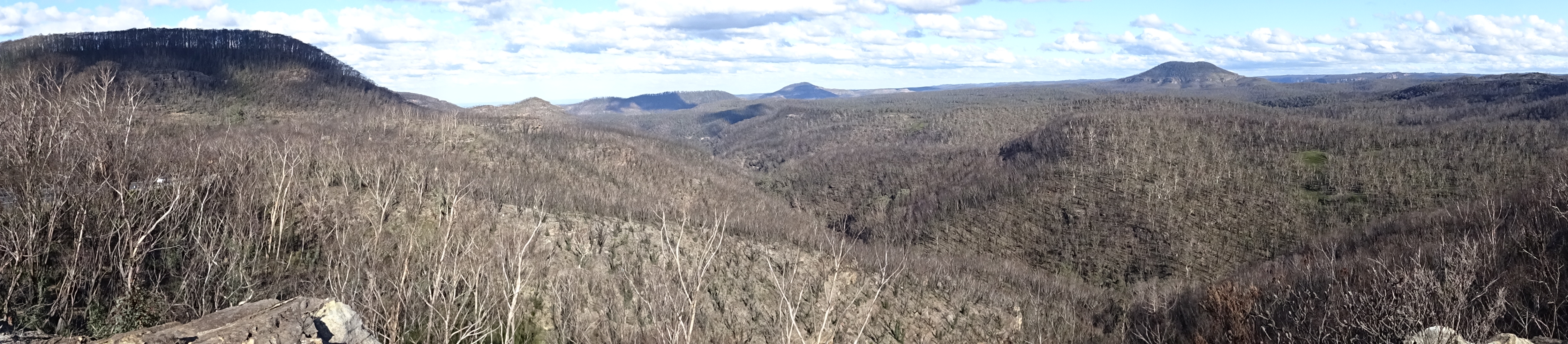
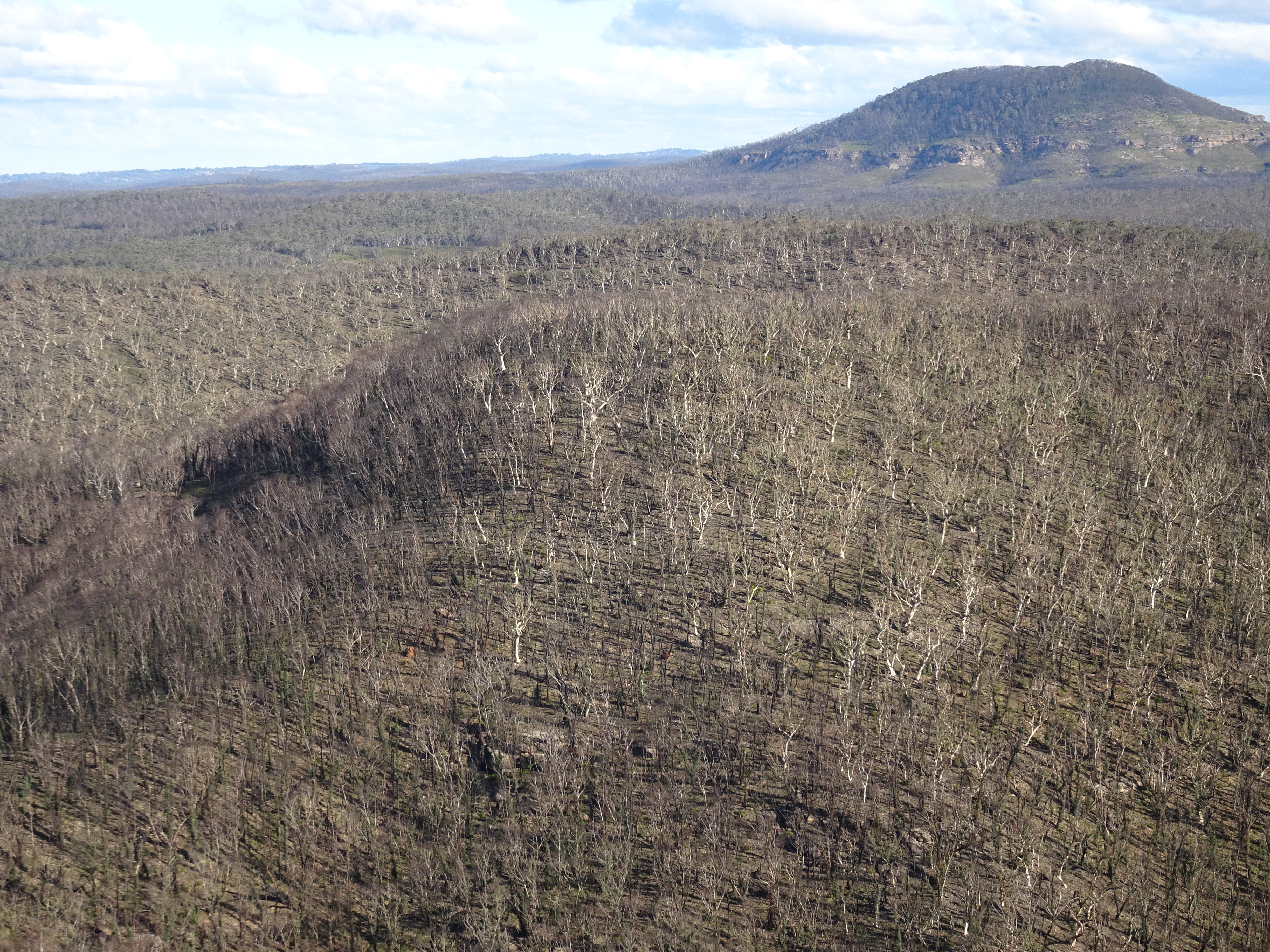
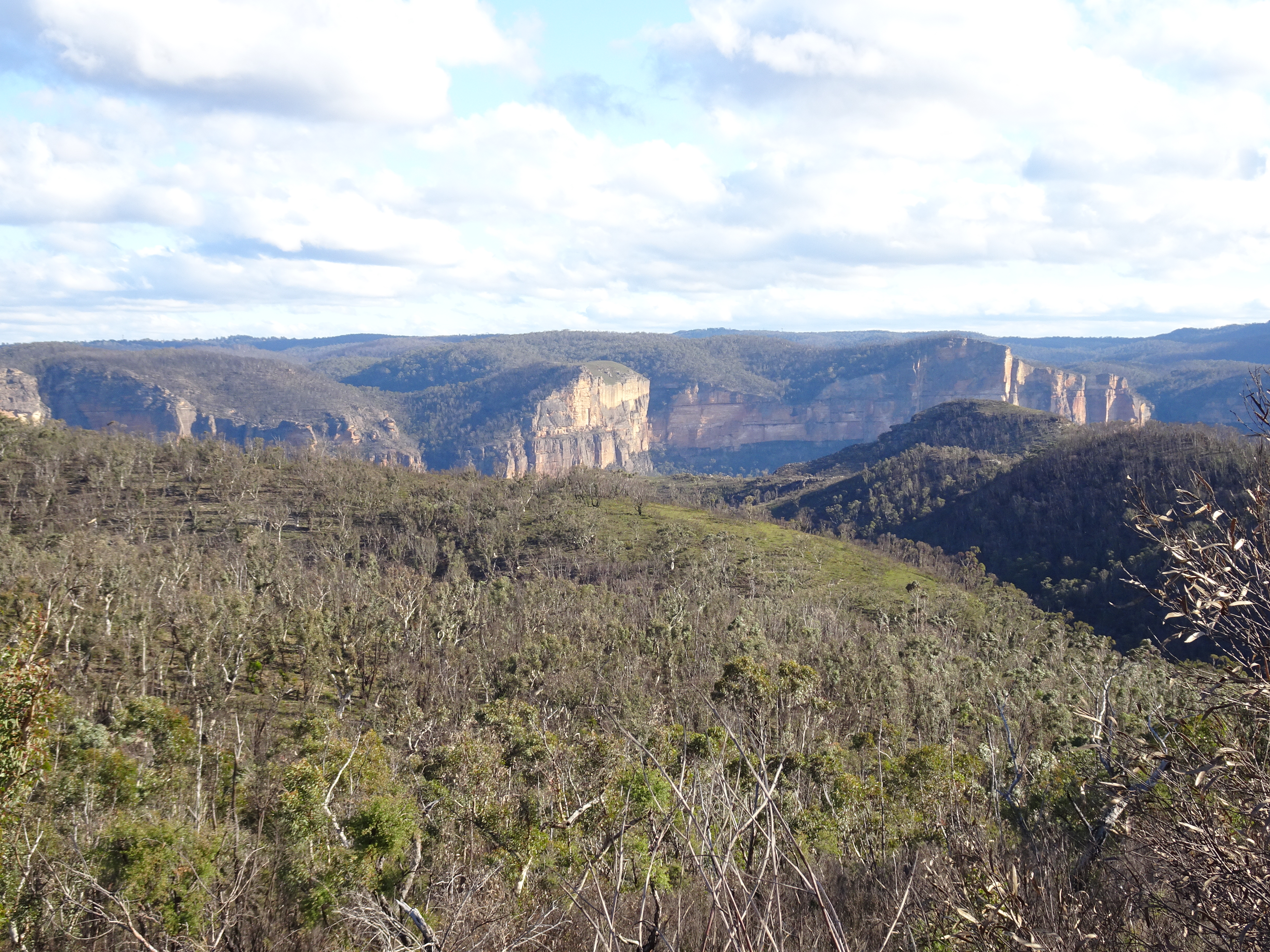
The mountains are so named because the plethora of gum/eucalyptus trees give the air a blue tinge. However, as a result of the recent devastating bush fires the air is clear at the moment. I was appalled at the sight of vast swathes of burned woodland. But I was equally amazed at how quickly new growth had begun, often from what appeared to resemble charcoal.


Another feature of crossing the mountains was the change in temperature. I had left the coast in the morning where people on the beach were enjoying 27C to be confronted in early afternoon by signs warning of snow and ice on the road.
It was a pleasure riding through the mountains, although a little chilly, and I reached Bathurst where I decided to stay in a typical traditional Aussie hotel complete with sports bar, TAB etc. I was told that I could park my bike in the courtyard at the rear of the hotel but in the event there were 4 other bikes before me and the landlord decided there was insufficient room for mine. Instead, I was able to park it in the adjacent drive through bottle shop’s storeroom when they closed at 2230.
Distance: 279 kilometres.
Friday 3 July
I retrieved my bike from the bottle shop as they opened at 0830 and then enjoyed a good cooked breakfast in the hotel. I spoke to the other 4 bikers who were about to start their return journey to the Northern Territory.
My route back to Wagga was almost identical to that taken on my last jaunt so was unremarkable and I made good time, despite early morning fog at Bathurst.
Distance: 324 kilometres.

Total distance travelled: 2513 kilometres.
No comments:
Post a Comment